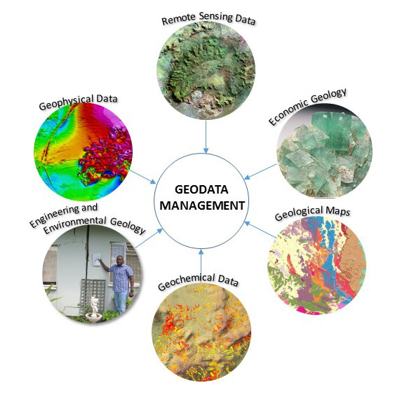
GEOGRAPHIC INFORMATION SYSTEMS (GIS)
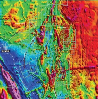
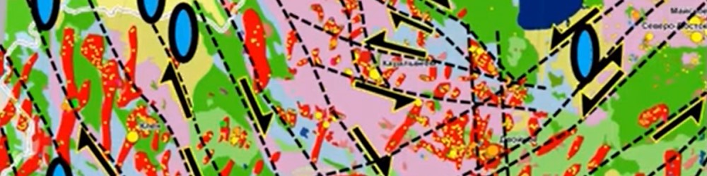
Any kind of geospatial data can be integrated into a GIS database and represented as data layers. Examples include mineral occurrences, geochem, drilling, geology, geophysics and satellite imagery. Alone, each dataset has blind spots; combined in 2D/3D GIS environment, they build a real picture of the subsurface showing relationships and trends of mineralisation.
Historic legacy data are a valuable resource for any exploration or mining company. Handwritten data, historical maps and old drillhole logs have to be converted into formats that can be utilized by GIS software. Conversion of old geologic maps from paper copies to new digital products is a complex task requiring efficient way to reduce errors.
Having clean and standardized data increase overall productivity and quality information. This, consequently reduce costs in resource targeting campaign.
I provide a range of data service to my clients, from legacy data assessments, data capture, data quality checks, data integration into a coherent and validated spatial database.
SERVICES PROVIDED- Setting up exploration geodatabase
- Compiling and integrating data from remote sensing, geology, drilling, geochem and geophysics
- Integrating historical data into geodatabase
- Producing maps, drill sections and 2D/3D model of mineral deposits
- Maintaining and refining drilling and sampling databases
- Data verification, data validation, data cleaning
- Geospatial data analysis
- Site selection analysis