REMOTE SENSING APPLICATIONS TO GEOLOGY & MINERAL EXPLORATION
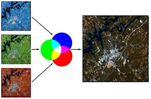
Remote sensing is the process of acquiring information about the Earth's surface without actually being in contact with it. Reflected or emitted electromagnetic radiation is sensed, recorded, processed, analyzed and applied to gather information Typically, satellites or high altitude aircrafts carry the sensors.
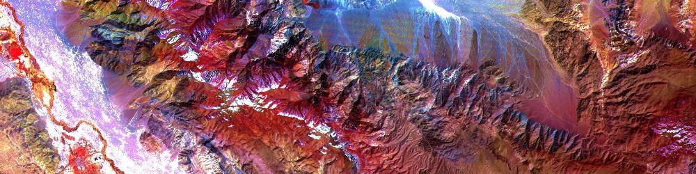
Remote sensing has been a valuable tool in mineral exploration separating favorable areas from the rest. Wide and inaccessable areas can be screened rapidly with little expenditure. Lithology, geological structures, mineral alteration, vegetation types can be mapped analysing satellite remote sensing data.
- Acquiring data from earth observation satellites
- Spectral data processing and analysis
- Mapping lithology, structure and mineral alteration
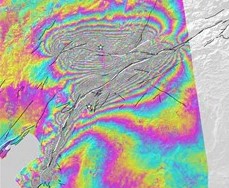
- Satellite Radar interferometry applications
- Ground change detection
- Detecting ground deformation
- Mapping soil erosion and landslide risk areas
- Ground truthing, on-the-ground investigations